Survey Numbers, FMB and Boundary Disputes in Telangana
The documents say what you are buying; the survey says where it is. How survey numbers, sub-divisions and the tippan or FMB sketch work in Telangana, how surveys are done, and how to deal with shortfalls and encroachment.
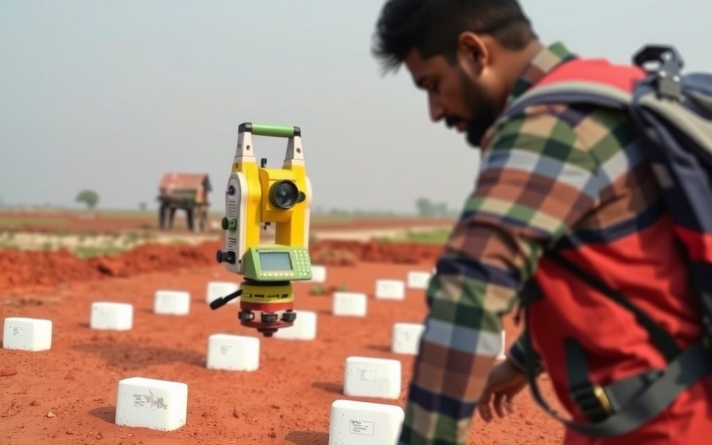
- 1 acre = 40 guntas = 4,840 sq yd; 1 gunta = 121 sq yd, about 1,089 sq ft
- In Telangana the FMB equivalent is the tippan; the village (tonch) map and sethwar complete the picture
- A licensed survey costs roughly ₹15,000 to ₹45,000 and takes days; a government survey can take months
- Pay on measured extent, not deed extent, and annex the survey sketch to the sale deed
- Adverse possession can run against private owners after 12 years, so act on encroachment early
| What | Indicative range | Note |
|---|---|---|
| Certified tippan, village map and sethwar extracts | ₹1,000 – ₹5,000 | indicative, Oct 2026, including retrieval |
| Licensed surveyor with total station or DGPS | ₹15,000 – ₹45,000 per parcel | indicative, Oct 2026; depends on extent and terrain |
| Boundary pillars fixed with neighbours present | ₹500 – ₹1,500 per pillar | indicative, Oct 2026 |
| Government survey or boundary determination | 1 – 6 months | prescribed official fee; verify current rate |
| Formal sub-division of a survey number | 1 – 4 months | typical; longer if objections are raised |
| Value of a 1-gunta shortfall at ₹2.5 Cr per acre | ≈ ₹6.25 L | worked figure; scale to your rate |
Ranges reflect recent transactions and advisor observation as of 2026-10. Always verify against the sub-registrar market value and the specific parcel.
The documents tell you what you are buying; the survey tells you where it is. A surprising number of land problems in Telangana have nothing to do with forged deeds or prohibited lists and everything to do with geography: a parcel that is 4 acres 26 guntas on the ground but 5 acres in the deed, a neighbour's fence sitting 30 feet inside your boundary, or a seller who walks you round the wrong field altogether. Understanding survey numbers, the FMB sketch and boundary disputes in Telangana is how you avoid paying for land you will never possess. This guide explains how survey numbers and sub-divisions work, what the FMB, tippan and village map actually are in Telangana's record system, how a government or licensed survey is done, how to read the report, and what to do about encroachment and boundary disputes, as of October 2026.
We are property advisors, not surveyors or advocates. We work alongside licensed surveyors and property lawyers on every parcel, and you should too.
Who this guide is for
This guide is for buyers of agricultural land, farm plots and village-edge parcels, for owners who suspect a neighbour has moved a boundary, and for families who are dividing inherited land and need each share fixed on the ground. If you are buying a plot in an approved layout, the layout sketch is the main reference, but the same principles apply when the layout itself has to be fixed against the underlying survey numbers.
Survey numbers and sub-divisions explained
Every village in Telangana is divided into numbered survey fields, recorded in the settlement records prepared during the revenue surveys of the former Hyderabad State and maintained since. A survey number identifies a field as it stood at settlement, with its extent and classification. Over time, as land was partitioned, sold in parts or granted, survey numbers were split into sub-divisions. You will see them written as 123/A, 123/AA, 123/1, 123/1/A or with Telugu letter suffixes transliterated in different ways, which is itself a source of confusion.
Three things to understand about sub-divisions:
- A sub-division may exist on paper but not on the map. Many sales of part of a survey number were recorded in the revenue record without the survey department ever drawing the new line on the field sketch. The extent is known; the location within the survey number is not formally fixed.
- Different sub-divisions of one number can have different legal status. One may be private patta land, the next assigned land and the next government land. This is why our guide to assigned land and the 22-A prohibited list insists on checking every sub-division.
- The deed, the record and the ground can each give a different extent. The deed says what was sold, the record of rights says what is recorded, and the survey says what is actually there. They should agree; often they do not.
Measurement units in Telangana agricultural transactions are acres and guntas.
| Unit | Equivalent |
|---|---|
| 1 acre | 40 guntas = 4,840 sq yd ≈ 4,047 sq m ≈ 43,560 sq ft |
| 1 gunta | 121 sq yd ≈ 101.2 sq m ≈ 1,089 sq ft |
| 1 hectare | ≈ 2.47 acres ≈ 98.8 guntas |
| 1 cent (used in Andhra Pradesh, occasionally in Telangana deeds) | 1/100 acre = 48.4 sq yd |
A farm plot sold as "10 guntas" is therefore about 1,210 square yards, roughly a quarter of an acre. Plots in a residential layout are sold in square yards instead.
FMB, tippan, village map and sethwar: which record is which
Buyers, brokers and many lawyers in Hyderabad say "FMB" when they mean the official sketch of a survey number. FMB stands for Field Measurement Book, the term used in the Andhra and former Madras Presidency record system. In Telangana's former Hyderabad State areas, the equivalent records have different names, and asking for them by the right name gets faster results at the mandal office.
- Tippan. The field measurement record for a survey number, with its dimensions, offsets and the measurements taken at settlement. This is the closest equivalent to the FMB, and it is what a surveyor uses to re-establish the boundaries of a field.
- Village map, often called the tonch or cadastral map. The map showing all survey numbers in the village and their relative positions, along with roads, streams, tanks and village boundaries. It tells you where a field sits; the tippan tells you its exact shape.
- Sethwar. The settlement register listing each survey number with its extent, classification and assessment at settlement. It is the reference for the original extent of a survey number.
- Khasra pahani and pahanis. The 1954-55 khasra pahani and the annual pahanis are revenue records of ownership and cultivation, not maps, but they show how a survey number was held and split over time.
- Sub-division sketches. Where the survey department has formally sub-divided a number, there will be a sub-division record. Where it has not, the sub-division exists only in the revenue record.
Certified copies of these records come from the survey and land records department through the mandal and district offices. The record of rights on the land records portal, reachable at dharani.telangana.gov.in, which now redirects to Bhu Bharati, shows extents and holders, and map layers are being added as digitisation progresses, but the certified survey records remain the reference for boundary work.
How a survey is actually done
Government survey
An owner can apply to the revenue and survey authorities for a survey of their land, typically through the online services or the land records portal, paying a prescribed fee. The mandal surveyor or the Deputy Inspector of Survey issues notice to adjoining owners, attends the site, uses the tippan and village map to re-establish the field boundaries from fixed reference points, and records the result in a report with a sketch and a panchanama signed by those present. A government survey carries official weight, which matters if the result is later disputed. Its weakness is time: depending on the mandal's workload, it can take from a few weeks to several months.
Licensed private surveyor
For due diligence before a purchase, buyers usually hire a licensed private surveyor, who works from certified copies of the same records using a total station or DGPS equipment, and produces a digital sketch overlaying the parcel on the village map with coordinates. It is faster and gives the buyer a working answer within days. Under the Bhu Bharati framework, the state has provided for survey sketches to accompany land transactions and has been licensing private surveyors to prepare them; implementation is being phased in, so confirm whether the requirement applies in your mandal at the time of registration.
What a phone GPS app cannot do
Walking the boundary with a phone app gives a rough area, not a legal boundary. Errors of several metres are normal, which on a 1-acre parcel can mean a gunta or more. Use it to sanity-check the seller's story, never to settle a price.
Step-by-step: surveying a parcel before purchase
| Step | Action | Typical time | Indicative cost (as of October 2026, verify) |
|---|---|---|---|
| 1 | Get the exact survey number, sub-division and extent from the seller's deed and the record of rights | 1 day | Nil |
| 2 | Obtain certified tippan, village map and sethwar extracts | 3–15 days | ₹1,000 – ₹5,000 with retrieval |
| 3 | Licensed surveyor measures the parcel with total station or DGPS and overlays it on the village map | 3–10 days | ₹15,000 – ₹45,000 depending on extent and terrain |
| 4 | Compare deed extent, record extent and measured extent; identify encroachments, road or water-body overlaps | 1–3 days | Included in surveyor fee |
| 5 | Fix boundary stones or pillars with the seller and neighbours present | 1 day | ₹500 – ₹1,500 per pillar |
| 6 | Annex the survey sketch to the agreement and the sale deed; adjust price for measured extent | With the agreement | Nil |
| 7 | Government survey, where there is a dispute or the parcel needs formal sub-division | 1–6 months | Prescribed official fee plus follow-up |
Reading a survey report
When the surveyor's report arrives, read it for these points:
- Measured extent against deed extent. A difference of a gunta or two on several acres is common; larger gaps need explaining before you pay.
- Location within the survey number. Does the parcel sit where the seller said it does, and does it match the sub-division in the record?
- Frontage and access. Is the road shown on the village map, or is it a cart track across someone else's land? Recorded access is worth paying for.
- Overlaps. Any part of the parcel falling on a road, a stream, a nala, a tank bed or government land. Water bodies matter doubly near Hyderabad; see our guide on lake FTL and buffer zones.
- Encroachments. Neighbours' fences, wells, sheds or crops inside your boundary, or yours inside theirs.
- Boundary marks. Whether old survey stones were found, and whether new pillars were fixed by agreement with neighbours.
Boundary disputes and encroachment
Disputes generally take one of three forms: a neighbour has moved a fence, two owners honestly disagree where the line is, or someone is occupying part of the land outright. The usual sequence of remedies:
- Measure first, argue later. A licensed survey tells you whether you have a case. Many disputes end when both sides see the overlay.
- Government survey and boundary determination. The survey and boundaries law in force in Telangana, dating from 1923, lets survey officers determine disputed boundaries and fix survey marks, with an appeal within the department. Damaging or moving survey marks is an offence. A party unhappy with the determination can go to the civil court, but there are time limits, so take advice promptly.
- Civil suit. For a declaration of title, recovery of possession or an injunction against interference. Remember that adverse possession can ripen against a private owner after 12 years of open, continuous and hostile possession, so long-standing encroachments should not be left alone.
- Police complaint. Where there is deliberate trespass or intimidation, a complaint may be appropriate, alongside, not instead of, the civil and survey remedies.
- Agreement. Neighbours who agree a boundary should record it in a registered document with the sketch annexed, so that the next owner on either side is bound.
For a buyer, the simple rule is not to buy into an active dispute. If the survey shows an encroachment, make removal or a registered boundary agreement a condition before the balance is paid.
Resurvey and the future of Telangana's land maps
Telangana's settlement-era maps are old, and decades of informal sub-division mean that the record and the ground have drifted apart in many villages. The state has run pilot digital resurveys and, through the Bhu Bharati framework, has moved toward unique parcel identifiers and survey sketches linked to the record of rights. As these roll out, expect the record to become more precise, and expect some owners to discover that their recorded extent does not match their fields. If you are buying, a precise survey now protects you either way. If you already own land, a survey before any resurvey reaches your village lets you raise discrepancies with evidence in hand.
Getting a sub-division formally created
When you buy part of a survey number, or when a family divides land, the best protection is a formal sub-division recorded by the survey department, not just a revenue entry. The broad process is an application to the revenue and survey authorities with the registered sale or partition deed, the current record extract and a sketch; a survey by the mandal surveyor with notice to the co-owners and neighbours; and an order creating the new sub-division numbers, which then flow into the record of rights. It typically takes one to four months, depending on the mandal and whether anyone objects.
Formal sub-division matters for three practical reasons. A bank lending against the land wants a defined parcel. A NALA conversion or building permission application needs the exact parcel boundaries. And when a future buyer's surveyor checks your land, a formally sub-divided parcel removes the argument about where your extent sits within the larger number. In gated farm ventures, the absence of formal sub-division is one of the main reasons owners of small farm plots struggle to sell, finance or convert later.
Special cases: highway frontage, water bodies and forest edges
Highway and road frontage
Frontage parcels on the Bijapur highway, the Srisailam highway, the Rajiv Rahadari or the Warangal highway carry a premium, but road widening takes a strip from the front. The survey should show the current road boundary, any acquisition already notified or completed, and the line of any proposed widening. A parcel that measures 2 acres today may be 1 acre 32 guntas after widening, and if the acquisition was completed before you buy, the compensation went to the earlier owner.
Tanks, streams and nalas
Village maps show tanks, kuntas and streams, and the full tank level of a tank can extend well beyond the water you see in a dry year. Any part of a parcel inside a full tank level, or in the bed of a stream or nala, cannot be built on and is increasingly policed around Hyderabad. The survey overlay is the only reliable way to see how close the parcel comes.
Forest and government land edges
Parcels adjoining reserve forest or government land, common toward Vikarabad and on the northern edges of Medchal-Malkajgiri, need the forest or government boundary fixed on the ground. Fences that drift a few metres into forest land create problems for every later owner.
Worked example: a Keesara parcel that measured short
A resident client agreed in principle to buy 5 acres of farm land in a BT-road village a few kilometres beyond the ORR on the Keesara side, where land trades at roughly ₹2 crore to ₹4 crore per acre as of October 2026. The agreed rate was ₹2.5 crore per acre, ₹12.5 crore for the deed extent of 5 acres.
The licensed surveyor's report showed:
- Measured extent of 4 acres 26 guntas, a shortfall of 14 guntas against the deed.
- About 6 guntas lost to a widened panchayat road along the frontage, never compensated or recorded.
- About 8 guntas occupied by a neighbour's mango trees and a fence, apparently for at least fifteen years.
The arithmetic: 14 guntas is 14/40 of an acre, or 0.35 acre. At ₹2.5 crore per acre, that is ₹87.5 lakh. The client's position was simple: pay for what you get. The road strip could not be recovered, so the price was reduced by ₹37.5 lakh for those 6 guntas. For the 8 guntas under the neighbour's trees, the seller had two options: recover them through a government survey and boundary agreement before registration, or accept a further ₹50 lakh reduction. Because the neighbour's possession was long-standing and an adverse possession claim could not be ruled out, the seller chose the reduction.
The final deed described 4 acres 26 guntas with the survey sketch annexed and boundaries matching the ground, at ₹11.625 crore. Registration took place at the Keesara Tahsildar office, with duties of approximately 7.5% of the applicable value verified on the day, and mutation in the same step. Without the survey, the client would have paid ₹87.5 lakh for land he did not possess. For the area, see our page on farm land in Keesara.
Worked example: fixing shares when siblings divide land near Chevella
Three siblings inherited 9 acres in one survey number in a village near Chevella, recorded jointly after succession mutation. They wanted to divide it equally, but the land was not uniform: the northern block had road frontage and the best borewell, the southern block was lower and wetter.
A licensed surveyor mapped the parcel and the soil and water features. The siblings agreed on a division in which the frontage block was 2 acres 30 guntas, the middle block 3 acres and the southern block 3 acres 10 guntas, with the borewell on a shared strip and a 20-foot internal track giving each block access. The registered partition deed annexed the sketch, and the siblings then applied for formal sub-division and separate records. Because each sibling now had a defined, mapped parcel with recorded access, each block could later be sold or financed independently. See our page on agriculture land in Chevella for local values.
Mistakes we see in practice, and the fix for each
- Trusting the seller's walk-round. Sellers often point out the field their family has cultivated, which may not be the field they own on paper. Fix: a licensed survey before any significant advance.
- Paying for deed extent rather than measured extent. Fix: agree the rate per acre or per gunta and the final price on the surveyed extent.
- Ignoring the access route. A cart track across a neighbour's land is a permission, not a right. Fix: confirm the road on the village map, or obtain a registered right of way.
- Leaving the sketch out of the deed. Fix: annex the survey sketch to the agreement and the sale deed, with boundaries that match the ground.
- Buying "10 guntas out of survey 245" in a farm venture with no sub-division. You own an extent with no fixed location. Fix: insist on a mapped parcel in a sketch annexed to the deed, and see our guide on farm house plots near Hyderabad.
- Not involving neighbours when fixing pillars. Pillars fixed without neighbours present invite later disputes. Fix: notify adjoining owners and record their presence.
- Letting old encroachments sit. Fix: deal with encroachments promptly, given the 12-year adverse possession rule against private owners.
How NRR Estates handles surveys and boundaries for clients
We do not recommend paying more than a token advance on any agricultural parcel that has not been surveyed. When a client shortlists land, we obtain the certified survey records, brief a licensed surveyor, attend the measurement with the seller, and walk the client through the overlay: extent, location, access, overlaps and encroachments. We then translate the findings into the agreement, either as price adjustments based on measured extent or as conditions the seller must meet before the balance is paid, and we make sure the sketch is annexed to the sale deed. The survey sits alongside the title work in our guide to link documents and the title chain and the mutation steps in our guide to pattadar passbooks and mutation. Our fees are disclosed before any commitment.
For owners, including NRIs holding inherited farm land who cannot visit often, we arrange periodic surveys and boundary checks so that encroachments are caught early. NRIs and OCIs can hold inherited agricultural land but cannot buy farm land or farm plots; see our guide on NRI agriculture land rules in Telangana.
Survey numbers, FMB and boundaries: frequently asked questions
What is an FMB sketch in Telangana?
FMB means Field Measurement Book, the Andhra and former Madras Presidency term for the official sketch of a survey number. In Telangana's former Hyderabad State areas, the equivalent record is the tippan, which gives the field's dimensions and measurements from settlement. The village map, often called the tonch or cadastral map, shows where the field sits among others, and the sethwar gives the original extent and classification. Ask for these by name at the mandal or survey office and your request will move faster.
How do I find the survey number of a piece of land?
Start with the seller's sale deed and pattadar passbook, which state the survey number, sub-division and extent, then check the record of rights on the Bhu Bharati land records portal. To confirm that the land you are standing on is that survey number, obtain the village map and tippan and have a licensed surveyor fix the parcel on the ground. Never rely on a seller pointing out fields, because the land a family cultivates is not always the land recorded in its name.
How much does a land survey cost near Hyderabad?
As of October 2026, a licensed private surveyor using a total station or DGPS typically charges ₹15,000 to ₹45,000 for a farm parcel, depending on extent, terrain and how many survey numbers must be traced, plus about ₹1,000 to ₹5,000 for certified survey records. A government survey through the revenue and survey authorities costs a prescribed fee but can take one to six months. For a purchase decision, the licensed survey gives a faster working answer; for a dispute, the government survey carries official weight.
What if the land measures less than the deed says?
Find out why first: road widening, a neighbour's encroachment, a stream or tank overlap, or a deed that simply overstated the extent. Then pay for the measured extent. Agree the rate per acre or gunta and calculate the price on the surveyed figure. Where land can be recovered, such as from an encroachment, the seller can recover it before registration or accept a reduction. The sale deed should describe the measured extent with the survey sketch annexed, so the record matches the ground.
How are boundary disputes resolved in Telangana?
Begin with a licensed survey to see whether there is a real overlap. If the neighbour disagrees, apply for a government survey; the survey and boundaries law lets survey officers determine disputed boundaries and fix marks, with appeals within the department. A party unhappy with the outcome can file a civil suit, subject to time limits, for declaration, possession or injunction. Deliberate trespass can also justify a police complaint. Agreed boundaries should be recorded in a registered document with the sketch annexed.
Can a neighbour claim my land by adverse possession?
Against a private owner, a person who has been in open, continuous and hostile possession for 12 years can claim title by adverse possession, though the burden of proof is on the claimant and courts examine these claims strictly. That is why a long-standing fence or orchard inside your boundary should be dealt with promptly, by survey, notice and if necessary a suit. Against government land, limitation periods are longer. As a buyer, treat any long-standing encroachment as a reason to reduce the price or walk away.
What is a sub-division and why does it matter?
A sub-division is a part of a survey number created when land is partitioned, sold in parts or granted, written as 123/A, 123/1/A and so on. Many sub-divisions exist only in the revenue record, with no line drawn on the survey sketch, so the extent is known but its location is not fixed. Formal sub-division through the survey department gives you a defined parcel that banks, conversion authorities and future buyers can rely on. Different sub-divisions of one number can also have different legal status.
Do I need a survey sketch to register agricultural land?
The Bhu Bharati framework provides for survey sketches to accompany land transactions, and the state has been licensing private surveyors to prepare them, with implementation being phased in. Whether a sketch is mandatory for your transaction depends on the mandal and the date, so confirm with the Tahsildar office before booking the slot. Either way, we advise annexing a licensed surveyor's sketch to the agreement and sale deed, because it fixes what you bought on the ground and protects you in any later dispute.
Related guides

A sale deed is only as good as the deeds behind it. Why lawyers trace at least 30 years to a root of title, how partitions, GPA sales, wills and decrees fit in, and what a title opinion actually checks.
Agricultural land in Telangana mutates at the Tahsildar office in the same step as registration. What to do when it fails, how heirs get inherited land recorded, how corrections work, and why the passbook is not your title.

Assigned land, Bhoodan, endowment, wakf and government land cannot be sold to private buyers. How the POT Act and Section 22-A work, how to search a survey number, and what happens if you buy by mistake.
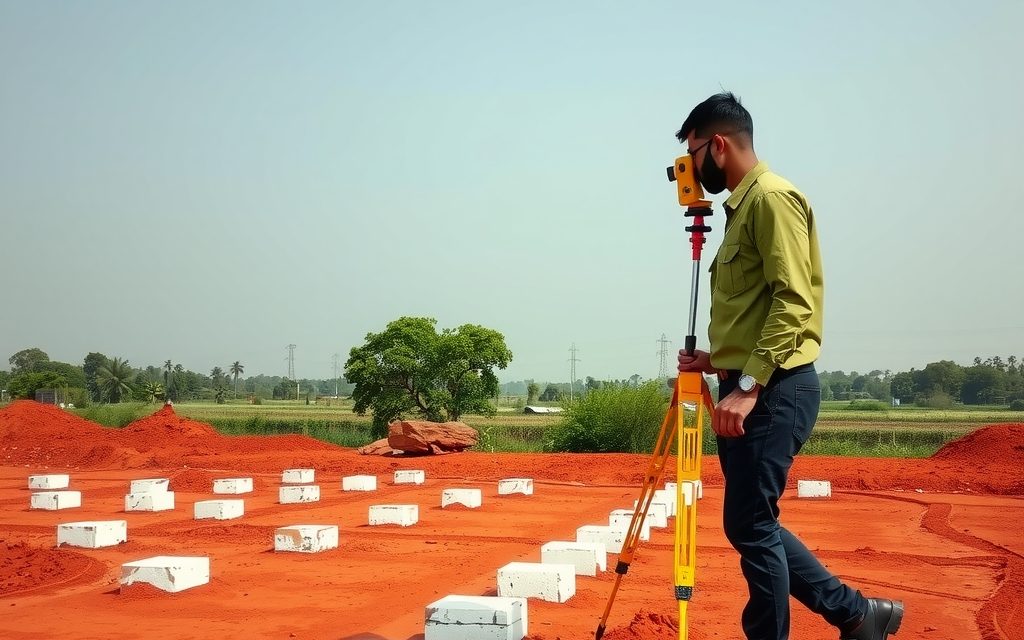
What lake full tank levels and buffer zones mean for plot, villa and flat buyers in Hyderabad: buffer distances, who draws the FTL, how HYDRAA enforces, how to check a property against lake maps, and why clean title is not enough.

A farm plot is usually agricultural land cut into guntas, not a residential plot. What you actually own, whether you can build a farmhouse, how managed ventures work, and indicative per-gunta prices across belts within about 60 km.

City-edge farm land beside the ORR on Hyderabad's north-east, around the Keesaragutta temple. Indicative per-acre and per-gunta prices, borewell reality, HMDA zoning and the forest, endowment and access checks Keesara needs.
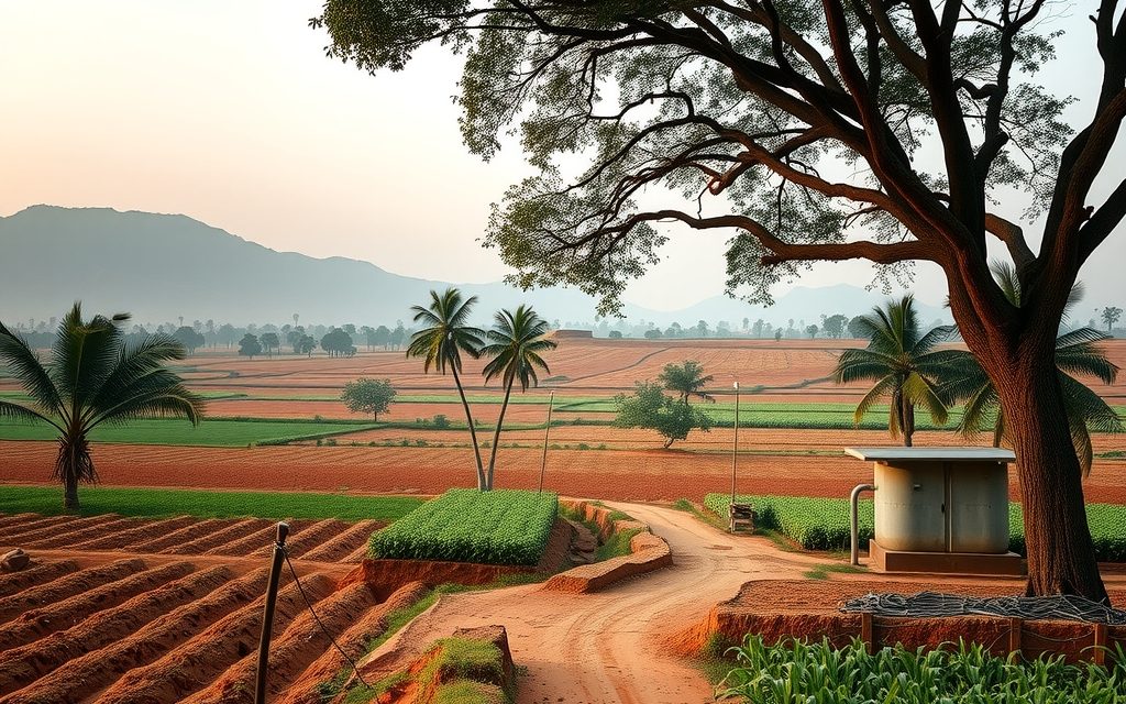
Hyderabad's long-standing weekend-farm belt on the Bijapur highway, about 40 km from Gachibowli. Red soil, mango and guava orchards and interior acreage still priced for real farming.

NRIs and OCIs cannot buy or receive gifts of agricultural land, plantations or farmhouses; inheritance is the only route. What inherited land allows, why benami workarounds are dangerous, and the lawful alternatives near Hyderabad.