Agriculture & Farm Land in Patancheru, Sangareddy
Farm land at the ORR's Patancheru exit, where an industrial belt meets mango orchards towards Rudraram and Isnapur. Groundwater and Nakkavagu checks come first; outer villages still trade at farm prices.
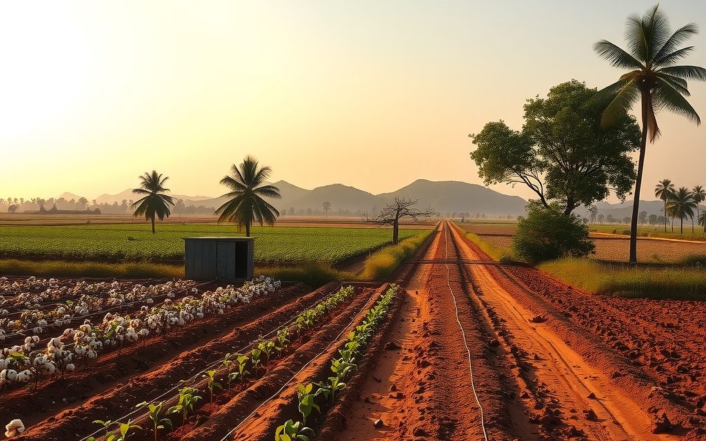
- 1–3 km from the ORR Patancheru interchange on NH 65; about 25 km from Gachibowli
- Agricultural land registers at the Patancheru Tahsildar office; converted land at the jurisdictional SRO
- About 55% of farms on borewells (300–700 ft); lab-test water near the industrial estates
- Red loam soil; cotton, maize, paddy and mango, sapota, guava orchards towards Rudraram
- Typical parcels 1–10 acres in outer villages; gated farm plots sold by the gunta
| What | Indicative range | Note |
|---|---|---|
| NH 65 or ORR-facing land near Patancheru town | ₹6 Cr – ₹12 Cr per acre | indicative, Oct 2026 |
| Inner ring within 3 km of town, BT road | ₹3.5 Cr – ₹7 Cr per acre | indicative, Oct 2026 |
| Middle ring towards Rudraram and Isnapur | ₹2 Cr – ₹4.5 Cr per acre | indicative, Oct 2026 |
| Outer villages 5–10 km off the highway | ₹1.2 Cr – ₹2.5 Cr per acre | indicative, Oct 2026 |
| Farm plots in gated farm ventures | ₹8 L – ₹18 L per gunta | indicative, Oct 2026 |
Ranges reflect recent transactions and advisor observation as of 2026-10. Always verify against the sub-registrar market value and the specific parcel.
Patancheru is not the first place most people picture when they think of farm land. It sits at the Outer Ring Road's Patancheru interchange on the Mumbai highway (NH 65), roughly 25 km north-west of Gachibowli, and for forty years it has been better known for pharma and chemical units, the BHEL township and the ICRISAT research campus than for farming. Yet agriculture land in Patancheru still changes hands every month, mostly in the villages that run north and west of the town towards Rudraram, Isnapur, Pati and the Gummadidala side of Sangareddy district. This guide is written for buyers who want to understand that market honestly: where genuine farm pockets survive, why groundwater and the Nakkavagu stream must be checked before anything else, what an acre costs as of October 2026, and how registration works at the Patancheru Tahsildar office.
We will be blunt where it matters. Some land here is excellent value for a long-term holder. Some of it sits downstream of decades of industrial effluent and should be avoided by anyone who wants to grow food, keep cattle or live on site. The difference is often one survey number.
Why buyers still look at Patancheru for farm land
Three kinds of buyer approach us about farm land around Patancheru. The first works in the western IT corridor or in the industrial belt itself and wants land within a 30 to 45 minute drive, which rules out most of the cheaper districts. The second is a land banker who has watched open plots in Ameenpur, Isnapur and Kollur climb and wants raw acreage one ring further out before it is converted. The third is a family that already owns ancestral land in the mandal and wants to add an adjoining parcel or understand what their holding is worth.
What all three share is proximity. Patancheru gives you the ORR, the Mumbai highway, the Regional Ring Road's planned northern arm further out, and an employment base of tens of thousands of workers. What it does not give you is clean, quiet countryside close to the town. That trade-off defines the market, and it is why we start every Patancheru conversation with the environment rather than the price.
The industrial belt in one paragraph
The Patancheru–Bollaram cluster grew from the 1970s onwards as one of the largest concentrations of bulk-drug and chemical manufacturing in the country, spread across the industrial development areas at Patancheru, Pashamylaram, Bollaram and Gaddapotharam and smaller estates nearby. Effluent from that cluster, before and even after the common treatment plant was set up, reached local streams, tanks and aquifers. The area has featured for years in national pollution indices, court proceedings and research papers on groundwater contamination. Conditions have improved with stricter enforcement, but contamination in soil and aquifers does not disappear on a political timetable.
Location, access and connectivity from Patancheru
Patancheru town and its farm villages sit in Patancheru mandal of Sangareddy district, on the north-western edge of the Hyderabad Metropolitan Development Authority (HMDA) area. Approximate distances from the town centre:
- ORR Patancheru interchange: 1 to 3 km, linking to the entire ring road and the western IT belt.
- Gachibowli and the Financial District: about 25 km via the ORR, typically 35 to 50 minutes outside peak hours.
- Miyapur and the Hyderabad Metro terminus: about 15 km along NH 65 through BHEL and Chandanagar.
- Sangareddy, the district headquarters: about 22 to 25 km further west on NH 65.
- Rudraram and Isnapur: 5 to 10 km north-west of the town, along the highway and the roads that branch off it.
- Rajiv Gandhi International Airport: about 55 to 60 km via the ORR.
The Mumbai highway is the spine. It carries heavy truck traffic from the industrial estates, and the stretch through Patancheru town and Isnapur junction is slow at shift-change times. Village roads branch north towards Pati, Ghanpur and Gummadidala and south towards Muthangi, Kardanur and Indresham, where the market is far more plotted than farmed.
The Regional Ring Road and what it means here
The northern arm of the planned Regional Ring Road passes well beyond Patancheru, through the Sangareddy region to the west and north. Its effect on the mandal is indirect: it strengthens the case for logistics and industry along NH 65 and pulls some land-banking interest towards the Sangareddy fringe. As of October 2026, land acquisition on the northern arm has progressed further than the southern arm, but exact interchange locations should be confirmed against official notifications rather than layout brochures. Anyone selling Patancheru farm land on the promise of an RRR exit "next door" is overselling.
Soil, water and what grows around Patancheru
The natural soil here is red loam over granite, with sandier, gravelly patches on the low ridges and heavier, darker soil in the low ground near tanks and streams. Away from contamination, this is reasonable farming soil: it drains well, takes drip irrigation readily and suits orchards.
Water sources: what our site visits show
By our observation, around 55 percent of the farm land in the mandal relies on borewells, about a quarter is rain-fed, around 10 percent still has open wells, and roughly 10 percent receives some canal or tank water. Bore depths of 300 to 700 feet are common, and yields drop sharply in summer in villages surrounded by industrial users and dense layouts.
Groundwater quality: the Patancheru-specific check
Quantity is the usual worry in Telangana farm land. In Patancheru, quality comes first. Studies over several decades by research institutions and the pollution control authorities have reported elevated dissolved solids, heavy metals and organic contaminants in groundwater and tank water in parts of the industrial belt and the villages downstream of it. The pattern is not uniform: some villages a few kilometres upstream or on a different drainage line test acceptably, while others close to the estates have historically been unfit for drinking or irrigation.
Our rule is simple. Before any advance on a Patancheru farm parcel, we arrange a water sample from the actual bore, tested at an accredited laboratory for total dissolved solids, hardness, fluoride, nitrate and a heavy-metal panel. Where the land has been farmed recently, a soil sample from two or three points is worth the modest cost too. If you plan to grow vegetables for your family, keep dairy animals or build a weekend home, treat these tests as non-negotiable.
Nakkavagu and the drainage line
The Nakkavagu is the stream that drains much of the Patancheru–Bollaram industrial area northwards towards the Manjira river. For years it carried industrial effluent, and villages along its course reported damaged crops, affected cattle and contaminated wells. Land along the Nakkavagu and its feeder nalas carries two separate issues. The first is environmental: soil and shallow aquifers along the stream are where contamination concentrates. The second is legal: nala and stream buffers restrict construction, and some land on the banks may be government or stream-bed land wrongly shown in private hands.
We map every Patancheru parcel against the drainage. A field a few hundred metres up-slope of the stream, on a separate catchment, is a different proposition from one sitting on its bank. Ask the seller directly which way the land drains in the monsoon and walk it after rain if you can.
What still grows here
Cotton and maize are the main field crops on the uplands, with paddy in low ground that has reliable water, and smaller areas of sugarcane, turmeric and vegetables. Mango orchards are common in the farm pockets towards Rudraram and Isnapur, with sapota and guava in smaller blocks. Many parcels near the town are not farmed at all: they are fenced, fallow and waiting for conversion, which tells you how the market prices them.
Where the farm pockets are: Rudraram, Isnapur and beyond
It helps to think of the mandal in three rings.
The inner ring around Patancheru town, Muthangi, the ORR interchange and the BHEL side is almost entirely a plot and commercial market. Agricultural land here is priced on what a layout or warehouse would fetch, and genuine farming is incidental. If that is your interest, the more direct route is open plots in Patancheru in approved layouts.
The middle ring along the highway towards Rudraram and Isnapur mixes industrial estates, gated villa projects and fenced agricultural parcels. Mango orchards survive here, often owned by families who have refused layout offers for years. This is where most farm-land enquiries end up. The villa market has moved in too; see villas in Isnapur for what has been built.
The outer ring north and west, towards Pati, Ghanpur, Lakdaram and the Gummadidala and Sangareddy borders, still feels agricultural. Prices drop noticeably once you are 5 to 8 km off the highway, water is generally better away from the estates, and parcels of 2 to 10 acres come up. This ring is where we would point a buyer who actually wants to farm, plant an orchard or build a weekend retreat. Further west, the market becomes the district-town market covered in our guide to agriculture land in Sangareddy.
Indicative prices for agriculture land in Patancheru
The ranges below reflect recent transactions and advisor observation as of October 2026. They are indicative, not quotes. Within each band, price depends on title quality, approach road width, frontage, water, HMDA zoning and distance from the industrial drainage.
| Location and parcel type | Indicative range | What drives it |
|---|---|---|
| NH 65 or ORR-facing land near Patancheru town | ₹6 Cr – ₹12 Cr per acre | Commercial and warehouse expectation; frontage depth matters |
| Inner ring within 3 km of the town, BT road access | ₹3.5 Cr – ₹7 Cr per acre | Priced as pre-layout land; HMDA zone decides |
| Middle ring towards Rudraram and Isnapur, orchard or farmed | ₹2 Cr – ₹4.5 Cr per acre | Mix of farm and land-bank demand; water quality varies |
| Outer villages 5–10 km off the highway | ₹1.2 Cr – ₹2.5 Cr per acre | Genuine farm pricing for the HMDA fringe |
| Parcels on or beside the Nakkavagu or industrial nalas | Discounted, often 20–40% below village rate | Contamination and buffer risk; many buyers rightly avoid |
| Farm plots in gated farm ventures | ₹8 L – ₹18 L per gunta | Check conversion, mother-parcel title and water tests |
Two pricing traps are common. The first is the "highway rate" quoted for land that is actually 4 km in on a cart track. The second is a cheap parcel that looks like a bargain until you discover it sits on the stream bank or in a zone where conversion is unlikely. A discount that reflects real contamination is not a bargain; it is the market telling you something.
Types of farm parcels offered around Patancheru
Patta farm land
Plain agricultural land with a pattadar passbook in the seller's name, usually 1 to 10 acres in the outer ring and smaller fragments closer in. This is the cleanest form of ownership if the title chain is sound. Expect family holdings with several co-owners, each of whom must sign.
Mango and sapota orchards
Established orchards of 10 to 25 years come up occasionally in the Rudraram–Isnapur pocket. A healthy orchard adds value, but get an independent view of tree health and yield, and remember that water quality affects fruit trees too.
Farm plots in gated farm ventures
Developers sometimes subdivide farm land into gunta-sized "farm plots" with fencing, internal roads and plantation. Near a city edge like Patancheru, check carefully whether each buyer gets an independent registered title and passbook, whether the developer has any approval, and whether the sale is really a disguised unapproved layout. Agricultural land cannot be sold as residential plots without conversion and layout approval.
Land with farmhouse or warehouse potential
Some buyers want land they can eventually convert. Whether that is realistic depends on the HMDA master plan zone for the survey number and on buffers. Industrial-zoned land, residential-zoned land and land in a conservation or agricultural zone are three very different assets even if they look identical on the ground.
Buffers, zoning and the conversion question
Patancheru mandal lies within HMDA's planning area, so every survey number carries a land-use designation in the master plan. Before you discuss price, find out four things.
- Master plan land use: residential, industrial, commercial, agricultural or conservation. This decides what the land can become and how lenders and future buyers will value it.
- Industrial buffers: some land near the estates falls inside green belts or buffer strips where construction is restricted.
- Water body buffers: tanks in the mandal have full tank level (FTL) boundaries and buffer zones, and nalas such as the Nakkavagu carry their own buffers. Our guide to lake FTL and buffer zones explains how these are measured and enforced.
- Road widening: master plan roads and highway widening can take a strip from frontage parcels, which affects both value and usable area.
Conversion of agricultural land to non-agricultural use requires NALA conversion and then layout or building approval from the planning authority. Do not buy assuming a conversion that the zoning does not support.
Legal checklist for Telangana agricultural land in Patancheru
The documents are the same across Telangana, but Patancheru adds wrinkles because so much land has been through earlier development agreements, acquisitions and part-sales. Our checklist:
- Pattadar passbook in the seller's name, matching the survey number and extent being sold.
- Bhu Bharati record (the system that replaced Dharani in 2025) showing the seller as pattadar, with no prohibited or disputed flag. Check it yourself on the official land records portal at dharani.telangana.gov.in.
- Pahani / 1B records for as many years as are available, to confirm possession and cultivation history.
- Encumbrance certificate for at least 30 years, to surface mortgages, earlier sales and agreements.
- Link documents: every deed in the chain back to the original pattadar or grant, including partition deeds and succession documents.
- Survey number and FMB sketch, followed by a licensed surveyor fixing boundaries on the ground. Sub-divisions here are frequent and boundary errors common.
- NALA status: whether any part has been converted, and if so whether the conversion is genuine.
- Section 22-A prohibited list: government land, endowment land, wakf land and certain assigned lands cannot be registered. Check the survey number against the list.
- Assigned land caution: land assigned to landless families cannot be sold in breach of the transfer prohibition. Never buy it.
- 58/59 regularisation: where government land occupation was regularised, read the terms and any resale restrictions.
- Acquisition and industrial notifications: check whether the industrial infrastructure corporation, highways authority or any other body has notified the land.
- Forest, urban land ceiling and agricultural ceiling checks for larger holdings.
- Earlier development agreements or GPAs: common near Patancheru; a seller may already have signed land away to a developer.
We add one Patancheru-specific item: an environmental note on the file, recording the water and soil test results and the parcel's position relative to the industrial drainage. It protects you at resale as much as at purchase.
Registration at the Patancheru Tahsildar office: process and charges
Unconverted agricultural land in Patancheru mandal registers at the Patancheru Tahsildar office, where the Tahsildar acts as joint sub-registrar under the integrated land records system. A slot is booked online, buyer and seller attend with witnesses and identity documents, and registration and mutation are completed together, so the record updates in the buyer's name in the same step.
NALA-converted land, plots, villas and other non-agricultural property register instead at the jurisdictional sub-registrar office, which for this belt is typically the one serving Patancheru. We confirm the exact office from the survey number before booking.
| Charge | Approximate rate | Notes |
|---|---|---|
| Stamp duty | About 5.5% of market value | Computed on the higher of declared consideration and government market value |
| Transfer duty | About 1.5% | Collected with stamp duty |
| Registration fee | About 0.5% | Plus mutation and passbook fees at the Tahsildar office |
| TDS under Section 194-IA | Generally not applicable to rural agricultural land | Applies to urban or converted property above ₹50 lakh; get CA advice where the land's status is borderline |
Together these come to roughly 7.5 per cent of the market value. Rates and market values are revised from time to time, so verify current figures on the registration department portal at registration.telangana.gov.in or on the day at the office. A quick note on TDS: some land near Patancheru may fall within distances from municipal limits where it is not treated as rural agricultural land for income tax purposes. Where that is possible, a CA should confirm the position before the payment schedule is fixed.
Farming near an industrial belt: practical costs and precautions
If you buy in the outer ring to farm or plant, budget for the setup honestly. Indicative figures as of October 2026, which vary widely with parcel size and terrain:
- Boundary fencing with stone posts and chain-link: often ₹2.5 lakh to ₹5 lakh per acre of perimeter, depending on shape.
- New borewell with pump and wiring: ₹1.5 lakh to ₹4 lakh, with no guarantee of yield.
- Drip irrigation for an orchard: commonly ₹50,000 to ₹1.2 lakh per acre before any subsidy.
- Water testing and periodic re-testing: a few thousand rupees per sample, worth repeating each year.
- Rainwater harvesting and a farm pond: the best defence against both falling yields and poor bore water quality.
Near the estates, harvested rainwater is often better than bore water. Several owners in the middle ring now run orchards substantially on a farm pond and drip, using the bore only as backup. It is a sensible model here.
Who should buy farm land around Patancheru, and who should not
Good fit:
- Long-term land bankers comfortable holding 7 to 12 years in the middle or outer ring, with land chosen for zoning and access rather than crops.
- Families wanting a weekend orchard within 40 minutes of the western IT corridor, who will test water, harvest rain and accept that the setting is semi-industrial.
- Existing landowners consolidating adjoining parcels with clean titles.
Poor fit:
- Anyone wanting organic or natural farming with certification, unless the specific parcel's soil and water tests are clean and stay clean.
- Buyers expecting quiet countryside; truck traffic, chimneys and occasional odours are part of the mandal.
- Short-term traders hoping to flip within two years; transaction costs and slow conversions make that hard.
- Buyers who will not pay for testing. In Patancheru, saving a few thousand rupees on a lab test can cost lakhs.
If you want cleaner countryside within similar driving time, compare farm land in Kollur to the south-west or the Shankarpally belt, where groundwater quality is not shadowed by an industrial cluster.
Patancheru against its neighbours
Kollur and the Shankarpally side offer a greener setting and are closer to the Financial District, but prices near the ORR are higher and the market is dominated by villa and plot developers. Sangareddy town's hinterland is cheaper and more agricultural, with better water away from industry, but it adds 20 to 30 minutes of driving. Patancheru's case rests on connectivity at a price below the south-western corridor. Choose it with eyes open, not because it is the first exit on the ORR.
NRI note: agricultural land in Patancheru
NRIs and OCIs cannot buy agricultural land, plantation property or farmhouses in India under FEMA rules, and they cannot receive such land as a gift either. The only route is inheritance: an NRI can inherit Patancheru farm land from a relative and may later sell it, but only to a resident Indian. Many NRI families we advise already hold ancestral land in Sangareddy district and want help managing, leasing or selling it. For investment from abroad, the permitted alternatives are approved open plots, villas and apartments. See our NRI guide to agricultural land rules in Telangana for the full position, and speak to a CA on tax and repatriation.
How NRR Estates helps you buy farm land in Patancheru
Our work in this belt is shaped by its specific risks:
- Goal-first shortlisting: we separate land-bank parcels in the middle ring from farm parcels in the outer ring so you are not comparing unlike assets.
- Environmental screening: drainage mapping against the Nakkavagu and industrial nalas, plus laboratory water and soil tests arranged before any advance.
- Zoning and buffer checks against the HMDA master plan, tank FTL boundaries and industrial green belts.
- Document verification: passbook, Bhu Bharati record, pahanis, a 30-year EC, link documents and earlier development agreements, with an independent advocate's title opinion.
- Survey and negotiation using registered village comparables rather than highway rates.
- Registration and mutation at the Patancheru Tahsildar office, with follow-up until the record and passbook show your name.
Our fee is disclosed before you commit. After purchase we can connect you with fencing, drip and farm-pond contractors and with caretakers who know the area.
Patancheru farm land: frequently asked questions
What is the price of agriculture land in Patancheru per acre?
As of October 2026, indicative ranges run from about ₹1.2 crore to ₹2.5 crore per acre in outer villages 5 to 10 km off the highway, ₹2 crore to ₹4.5 crore in the middle ring towards Rudraram and Isnapur, and ₹3.5 crore to ₹7 crore within 3 km of the town. Land facing NH 65 or the ORR trades at ₹6 crore to ₹12 crore on commercial expectations. Parcels beside the Nakkavagu or industrial nalas usually sell at a discount. These ranges reflect recent transactions and advisor observation.
Is groundwater around Patancheru safe for farming?
It depends on the exact parcel. Research and pollution control studies over decades have reported contaminated groundwater in parts of the Patancheru–Bollaram industrial belt and villages downstream of it, while land on a different drainage line or further from the estates often tests acceptably. Before paying any advance, have the actual bore water tested at an accredited laboratory for dissolved solids, fluoride, nitrate and heavy metals, and test soil if the land has been farmed. Rainwater harvesting and a farm pond reduce dependence on bore water.
Why does the Nakkavagu matter when buying farm land?
The Nakkavagu drains much of the industrial area northwards towards the Manjira river and historically carried industrial effluent. Soil and shallow aquifers along it are where contamination concentrates, and the stream and its feeder nalas also carry legal buffers that restrict construction. Some bank land may even be stream-bed or government land wrongly shown in private hands. We map every parcel against the drainage and treat land on the stream bank with real caution, regardless of how attractive the price looks.
Where are the genuine farm pockets near Patancheru?
Most genuine farming survives in the middle and outer rings. Mango and sapota orchards are found in the pocket towards Rudraram and Isnapur, though that belt is increasingly mixed with industry and villa projects. Further north and west, towards Pati, Ghanpur, Lakdaram and the Gummadidala and Sangareddy borders, land is still farmed, prices fall once you are 5 to 8 km off the highway, and water is generally better. The inner ring near the town and ORR is effectively a plot and commercial market.
Where is agricultural land in Patancheru registered?
Unconverted agricultural land in Patancheru mandal registers at the Patancheru Tahsildar office, where the Tahsildar acts as joint sub-registrar under Telangana's integrated land records system. After an online slot booking, buyer, seller and witnesses attend with identity documents, and registration and mutation happen together. NALA-converted land and other non-agricultural property register at the jurisdictional sub-registrar office instead, typically the one serving Patancheru, which we confirm from the survey number before booking.
Can I build a farmhouse or warehouse on farm land in Patancheru?
Only with the right approvals. Patancheru is inside the HMDA planning area, so each survey number has a master plan land use. You would need NALA conversion and then building or layout permission, and that is only realistic where the zone supports it and the land is clear of industrial green belts, tank FTL and buffer zones, nala buffers and road widening. Agricultural or conservation-zoned land is unlikely to convert soon. Confirm the zone before you agree a price, not after.
Can NRIs buy agricultural land in Patancheru?
No. Under FEMA rules, NRIs and OCIs cannot purchase agricultural land, plantation property or farmhouses in India, and they cannot receive such land as a gift. They can inherit agricultural land from a relative and may later sell it, but only to a resident Indian. NRIs who want exposure to the Patancheru and western corridor usually buy approved open plots, villas or apartments instead. A CA should advise on tax and repatriation of any sale proceeds.
Is Patancheru better than Kollur or Sangareddy for farm land?
Each suits a different buyer. Kollur and the Shankarpally side are greener, closer to the Financial District and free of the industrial groundwater shadow, but land near the ORR costs more and is dominated by plot developers. Sangareddy's hinterland is cheaper and more agricultural but adds 20 to 30 minutes of driving. Patancheru offers ORR and highway connectivity at a lower price than the south-west, but only makes sense if the specific parcel passes water, soil, drainage and zoning checks.
Related guides
HMDA plots on the Mumbai highway at the ORR Patancheru exit: Rudraram, Isnapur and Muthangi pockets, indicative per-sq-yd prices, industrial-belt realities and the document checks to run before paying an advance.
Independent and gated villas across the Patancheru belt on the Mumbai highway, from Ameenpur and Beeramguda to Isnapur, with indicative prices, HMDA approval checks, water-quality advice and commute times to the IT corridor.
Mid-segment gated, row and independent villas in Isnapur on the Mumbai highway near the ORR Patancheru exit, with indicative prices, industrial-buffer and groundwater checks, approvals and resale outlook.
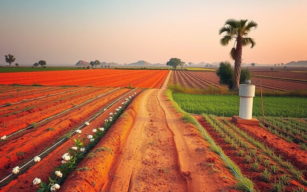
District-headquarters farm land on the Mumbai highway, 25 km past the Patancheru ORR exit. Red loam and black soil, cotton and maize country, larger blocks at a fraction of inner-ring prices.
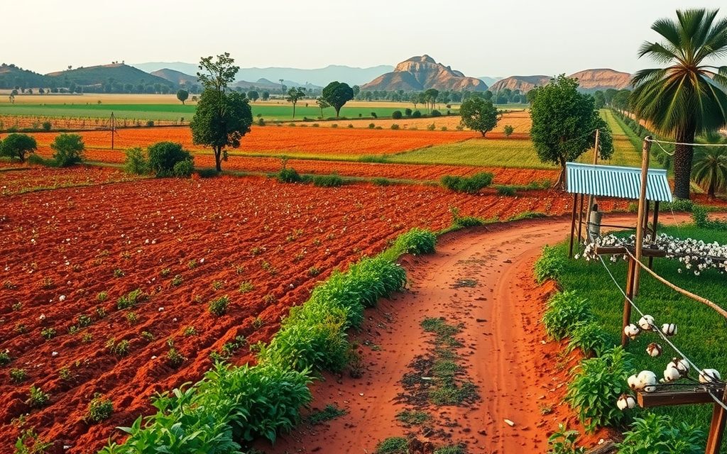
Little genuine farmland remains near Kollur's ORR interchange. What is left towards Velimela, Isnapur and Patelguda trades as development land. Indicative per-acre bands, NALA conversion economics and why an approved plot is often the honest answer.
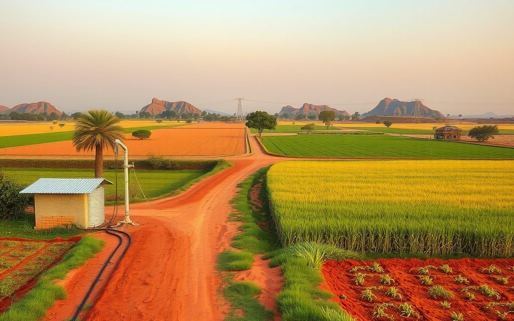
Mandal-town farm land 18 km past the ORR with a railway station, red soil and village tanks. More acres per rupee than Mokila, still within an hour of Gachibowli.
NRIs and OCIs cannot buy or receive gifts of agricultural land, plantations or farmhouses; inheritance is the only route. What inherited land allows, why benami workarounds are dangerous, and the lawful alternatives near Hyderabad.
What lake full tank levels and buffer zones mean for plot, villa and flat buyers in Hyderabad: buffer distances, who draws the FTL, how HYDRAA enforces, how to check a property against lake maps, and why clean title is not enough.