Agriculture & Farm Land in Ananthagiri, Vikarabad
Forest-edge farm land below the Ananthagiri hills, about 50 km beyond the ORR near Vikarabad. Red soil, custard apple and mango, cooler weekends, and forest-boundary checks that decide whether a parcel is worth buying.
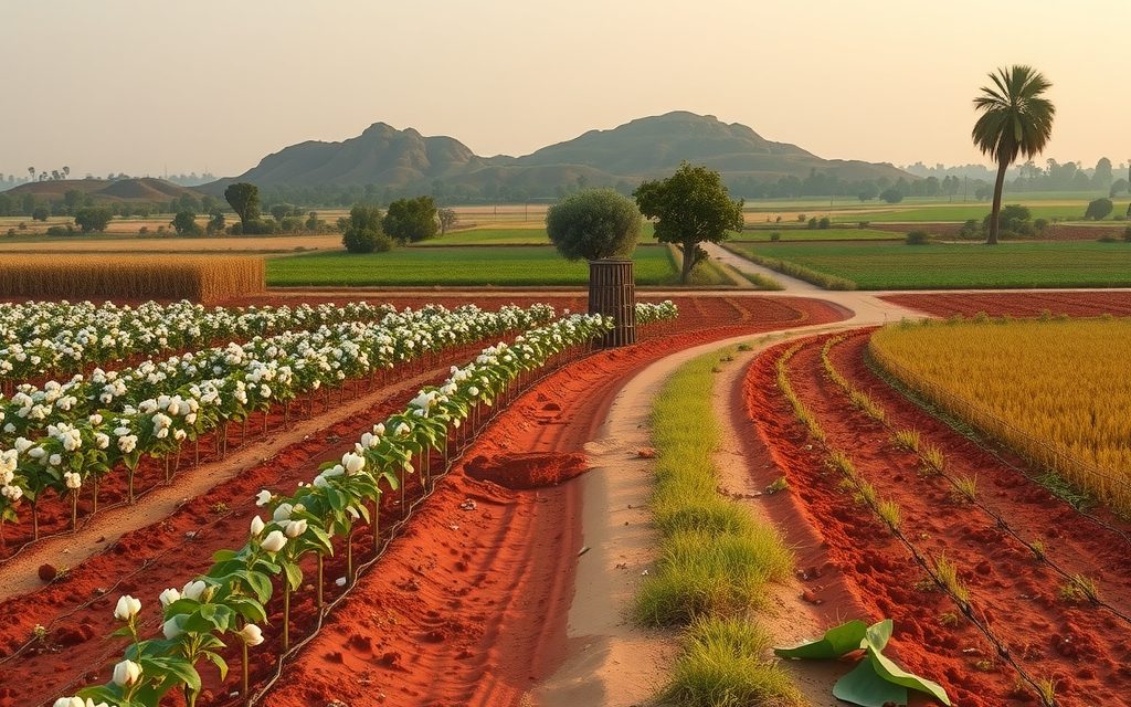
- About 6 km from Vikarabad town, 50–55 km beyond the ORR and 75–80 km from Gachibowli
- Most villages register agricultural land at the Vikarabad Tahsildar office; converted land at the jurisdictional SRO
- About half the land is bore-irrigated (roughly 200–500 ft); close to a third is rainfed
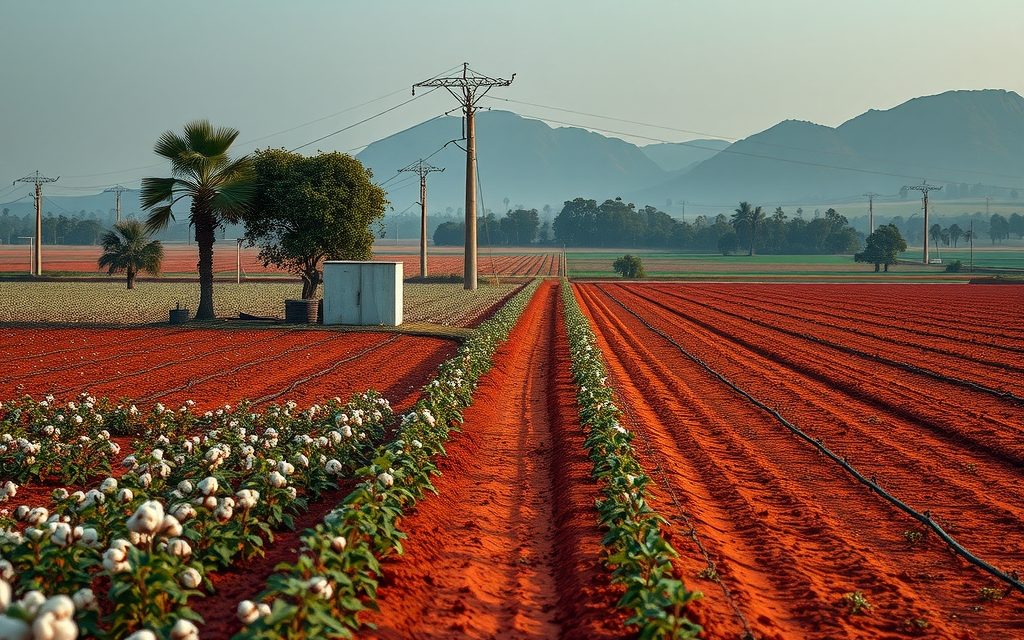
- Red, gravelly soils with sheet rock on slopes; custard apple, mango, guava, cotton and jowar
- Reserve forest boundaries must be verified on official maps before any advance
| What | Indicative range | Note |
|---|---|---|
| View parcels near the Ananthagiri road with metalled access | ₹70 L – ₹1.6 Cr per acre | indicative, Oct 2026; forest check essential |
| Villages toward the Kotpally side on a BT road | ₹40 L – ₹90 L per acre | indicative, Oct 2026 |
| Interior land with a working bore and panchayat road | ₹28 L – ₹55 L per acre | indicative, Oct 2026 |
| Rainfed slopes and rocky land, track access | ₹18 L – ₹35 L per acre | indicative, Oct 2026 |
| Farm plots in gated farm ventures | ₹2 L – ₹5 L per gunta | indicative, Oct 2026; check title structure |
Ranges reflect recent transactions and advisor observation as of 2026-10. Always verify against the sub-registrar market value and the specific parcel.
Agriculture land in Ananthagiri is bought for the view as often as for the soil. The Ananthagiri hills rise a few kilometres outside Vikarabad town in Vikarabad district, Telangana, carrying one of the few large reserve forests within a two-hour drive of Hyderabad, the hilltop Ananthapadmanabha Swamy temple and the source streams of the Musi river. The farm villages below the hills offer red soil, custard apple and mango orchards, cooler evenings and an unmistakably rural feel, roughly 50 km beyond the Outer Ring Road. They also carry a set of risks that city buyers routinely miss: forest boundaries that do not match what the seller points to, eco-tourism plans that need permissions agricultural land does not have, and water that disappears on the slopes in May. This guide covers indicative prices as of October 2026, how to check a parcel against the forest line, and how registration works at the Vikarabad Tahsildar office.
Every price below is an indicative range based on recent transactions and advisor observation. Around Ananthagiri, two fields side by side can differ widely in value because one touches the forest, one has a working bore, or one has a view and the other a rock face.
Why buyers want farm land near the Ananthagiri hills
Ananthagiri has been Hyderabad's nearest hill escape for generations. Families drive out for the temple, the viewpoints, the monsoon mist and the forest trails, and a historic chest sanatorium in the hills is a reminder that the air here was valued long before weekend farms became fashionable. That familiarity drives today's demand.
- Setting: forest on the skyline, undulating red earth, scattered tanks and small hamlets. Few belts near Hyderabad offer that combination at farm-land prices.
- Climate: the plateau and green cover keep summer evenings more comfortable than the city, which matters if you plan to spend nights on the land.
- Tourism footfall: resorts, homestays and day visitors create a small but real hospitality economy for those who convert land properly and run it lawfully.
- Orchard potential: custard apple thrives on the rocky slopes with little water, and mango does well in the deeper red loam of the valleys.
What Ananthagiri does not offer is an industrial or IT growth engine. Values here rise with lifestyle demand and the gradual improvement of roads from the city, not with jobs. Buyers who treat it as a quick-turn investment are usually disappointed; buyers who want to use the land, plant it and hold it for a decade or more tend to do well.
Getting there: roads, rail and distances
Two routes serve the hills. The northern route runs from Lingampally through Shankarpally to Vikarabad and then south-east toward the hills. The southern route follows the Hyderabad–Bijapur highway through Moinabad and Chevella before turning north. From Gachibowli, either takes about 90 to 110 minutes outside peak hours, longer on festival weekends when temple and tourist traffic builds.
| Point | Approximate distance from the Ananthagiri temple area |
|---|---|
| Vikarabad town and railway junction | About 6 km |
| Outer Ring Road (Tellapur, Kollur or Narsingi side) | About 50–55 km |
| Gachibowli / Hitech City | About 75–80 km |
| Chevella | About 30–35 km |
| Shankarpally | About 30 km |
| Rajiv Gandhi International Airport | About 95 km |
Vikarabad junction, on the Secunderabad–Wadi line with a branch toward Bidar, is a genuine convenience for caretakers and owners who prefer the train. Within the belt, the roads that matter are the Vikarabad–Ananthagiri ghat road, the roads toward the Kotpally (Kotepally) reservoir on the south-western side, and the village roads that branch off them. A parcel on a metalled road that stays open through the monsoon is worth considerably more than one reached by a red-earth track that turns to slurry in July.
The Regional Ring Road is not the story here
As currently discussed, the RRR's southern arm passes on the Chevella–Shankarpally side, between the city and Vikarabad. It may shorten the drive eventually, but it does not run through the hills. We do not price RRR benefit into Ananthagiri land, and you should be sceptical of anyone who does.
Forest, reserve land and the eco-sensitive question
This is the section that matters most on this page. The Ananthagiri hills are notified reserve forest, administered by the forest department. Reserve forest land cannot be bought or sold, and the Forest Conservation Act restricts its use for non-forest purposes. The difficulty for buyers is that the boundary between forest and private patta land is not always where a fence, a road or a seller's gesture suggests.
Reserve forest versus an eco-sensitive zone
Buyers often ask whether Ananthagiri is an "ESZ". Formal eco-sensitive zones are notified under environmental law around national parks and wildlife sanctuaries, and they come with lists of permitted, regulated and prohibited activities. Ananthagiri is a reserve forest, which is a different legal category. As of October 2026 we are not relying on any ESZ notification for the hills, but notifications and draft proposals do change, and other rules, including local development regulations and tourism guidelines, can still apply near forest land. Our position is simple: for any parcel within a couple of kilometres of the forest, we check the forest boundary on official maps, confirm whether any ESZ or similar notification has been issued or proposed for the area, and record the result in writing before you pay an advance.
How we check a forest-edge parcel
- Compare the survey number with the forest compartment maps held by the forest department, not with a seller's sketch.
- Have a licensed surveyor fix the boundary on the ground using the FMB and the village map, and note any forest boundary pillars nearby.
- Check the pahani history for classifications that hint at forest, poramboke or government land in the past.
- Look for joint survey disputes. Some villages near reserve forests have had boundary disputes between revenue and forest records; ask the Tahsildar's office whether the survey number has any such history.
- Walk the land with neighbouring farmers and ask where the forest begins. Locals usually know when the official line and the practical line differ.
If a parcel fails any of these checks, we advise walking away or renegotiating to exclude the affected portion. A beautiful acre that turns out to be forest land is worth nothing to you.
Soil, water and orchards below the hills
Red earth with rock
The soils are red, often shallow and gravelly on slopes, with deeper red loam in valley bottoms and below tanks. Lateritic patches and exposed sheet rock are common. Measure the usable area, not the paper area. On a ten-acre slope it is not unusual to find a quarter of the land is rock or too steep to cultivate. That land still has value as a view or a building pad once converted, but it will not grow a crop.
Where the water comes from
Borewells irrigate about half the farmed land, open wells about a sixth, and close to a third is rainfed. Bores of roughly 200 to 500 feet are typical; yield is very location-specific and generally better in valleys and near tanks than on ridges. The Kotpally reservoir and small tanks support some fields, but most parcels you will see depend on their own bore. Forest streams that flow in the monsoon usually dry up by February.
Practical advice: see the bore run in summer, ask for its yield in the driest month, and if the parcel has no bore, commission a hydro-geological survey before you agree on a price. On slopes, also budget for water-harvesting trenches and a farm pond; they make a measurable difference to orchards here.
Crops and trees that suit Ananthagiri
- Custard apple: the signature tree of the belt, tolerant of rocky, dry slopes and in demand in Hyderabad markets during the season.
- Mango: better in deeper valley soils with drip irrigation; established orchards earn a premium.
- Guava: productive on drip, quicker to bear than mango.
- Field crops: cotton, maize and jowar in kharif on rainfed land; paddy and vegetables only where water allows.
- Teak: planted in blocks and along boundaries. Cutting and transporting teak, even from private land, generally needs forest department permission, which is stricter near reserve forests.
Wildlife and crop damage
Being next to a forest has a cost that brochures never mention. Wild boar, peafowl and monkeys damage crops near the forest edge, and boundary fences need to be stronger than in open farmland. Factor fencing and some crop loss into your plan, particularly for vegetables and young orchards.
Farm land prices around Ananthagiri
These per-acre ranges reflect recent transactions and advisor observation as of October 2026. View, forest distance, water and road access drive the spread.
| Parcel type | Indicative range | Main risk to check |
|---|---|---|
| View parcels near the Ananthagiri road with metalled access | ₹70 L – ₹1.6 Cr per acre | Forest boundary, tourism rules |
| Villages toward the Kotpally side on a BT road | ₹40 L – ₹90 L per acre | Tank and FTL portions |
| Interior land with a working bore and panchayat road | ₹28 L – ₹55 L per acre | Bore yield, rock share |
| Rainfed slopes and rocky land, track access | ₹18 L – ₹35 L per acre | No water, monsoon access |
| Farm plots in gated farm ventures | ₹2 L – ₹5 L per gunta | Parent title, forest proximity |
These sit slightly above the bands on our Vikarabad farm land page for comparable parcels with views, and at the same level for ordinary interior land. The "hill premium" is real only for parcels that genuinely face the forest and have clean boundaries.
The gunta arithmetic
Ventures around the hills price by the gunta, one-fortieth of an acre or about 121 square yards. At ₹4 lakh per gunta, you are paying ₹1.6 crore per acre equivalent. Raw land a few kilometres away may cost a quarter of that. The difference buys fencing, plantation, a gate and management, plus the developer's margin. Ask yourself whether you are buying land or a service, and price it accordingly.
Parcel types and what each is good for
Patta land with a view
Two to ten acres on rising ground facing the hills. The most sought-after and the most legally sensitive. Ideal for a weekend farm with a modest farmhouse after conversion, provided the forest check is clean.
Valley orchard land
Lower, flatter fields with deeper soil and better bores, often already planted with mango or guava. Less dramatic, more productive. The right choice if you want a working orchard.
Large rainfed blocks
Ten acres and more of dry, rocky land at the lowest per-acre prices. Suitable for patient land banking or custard apple and teak, but vulnerable to encroachment if left unwatched.
Managed farm plots
Fenced, planted plots sold by the gunta with maintenance contracts. Convenient for owners who visit rarely. Check whether each plot is a separately recorded sub-division or an undivided share, and read the maintenance terms closely.
Land for homestays or resorts
Some buyers want to build cottages or a small resort. Agricultural land cannot be used for that without NALA conversion and building permissions, and near forest land additional scrutiny is likely. Resorts around Ananthagiri have faced action over encroachment and permissions in the past. Our NALA conversion guide explains the process; plan for it before you buy.
Title and revenue checks for Ananthagiri parcels
On top of the forest checks above, run the standard Telangana agricultural land checklist, with particular care on the points that tend to go wrong near the hills.
- Passbook and Bhu Bharati entry: the seller's name, extent and survey number must match. Extent mismatches are common on rocky land that was never measured precisely.
- Pahani history: look for changes in classification and for any entry describing the land as government, poramboke or forest.
- Encumbrance certificate for 30 years and every link document back to the original pattadar.
- FMB and on-ground survey: essential here because boundaries on slopes and near forests drift over time.
- Section 22-A prohibited list: confirm the survey number is not listed as government, endowment, wakf or other prohibited land.
- Assigned land: land granted to landless families cannot be bought; such parcels are common in hill villages and are sometimes offered with "regularisation coming" stories.
- Tank beds and FTL: exclude any portion within a tank's full tank level.
- Ceiling and 58/59 regularisation: confirm the land is not ceiling surplus or a regularised government plot with sale restrictions.
- NALA status: if a seller says the land is "converted", see the order and the survey numbers it covers.
The state land records portal lets you see the basic record online, but an online view is a starting point, not due diligence.
Registration and costs at Vikarabad
Most villages below the hills fall in Vikarabad mandal, so unconverted agricultural land registers at the Vikarabad Tahsildar office, with the Tahsildar acting as joint sub-registrar and mutation following in the same process. Some villages on the far side of the hills fall in neighbouring mandals and register with their own Tahsildar. NALA-converted land, plots and buildings register at the Vikarabad sub-registrar office or another jurisdictional SRO, which we confirm from the survey number.
| Item | Approximate figure | Comment |
|---|---|---|
| Stamp duty | ~5.5% | Assessed on the higher of price and government market value |
| Transfer duty | ~1.5% | Not levied in gram panchayat areas |
| Registration fee | ~0.5% (about 2% in gram panchayat areas) | Total remains close to 7.5% |
| Mutation | Nominal | Through Bhu Bharati after registration |
| Survey and legal verification | Varies with extent | Worth every rupee near forest land |
Plan for about 7.5% of value in duty and fees and expect us to verify current rates on the day. The 1% TDS under Section 194-IA does not apply to rural agricultural land, though parcels close to Vikarabad's municipal limits may be treated differently for income-tax purposes, which a chartered accountant should confirm.
A worked example: three acres below the hills
To make the numbers concrete, consider a typical enquiry: a Hyderabad family wants about three acres with a view of the forest, a bore, and space for a small farmhouse later. Here is how the budget usually builds up, using indicative figures as of October 2026.
| Component | Indicative cost | Comment |
|---|---|---|
| Land, 3 acres on a BT road with partial view | ₹1.5 Cr – ₹2.7 Cr | At ₹50 L – ₹90 L per acre |
| Stamp duty, transfer duty and registration fee | About 7.5% of value | On market value if higher than price |
| Survey, legal verification, forest map check | ₹50,000 – ₹1.5 L | Depends on title chain length |
| Chain-link fencing with stone pillars | ₹6 L – ₹12 L | Stronger near the forest edge |
| Bore deepening or new bore, motor, drip | ₹3 L – ₹8 L | Varies with depth and layout |
| Orchard planting and first-year care | ₹2 L – ₹5 L | Custard apple and mango mix |
A farmhouse is a separate decision. On agricultural land, building a residence generally requires conversion of the building footprint and the relevant permissions, and lenders rarely finance either. Families who skip that step and build first often find themselves unable to sell, mortgage or even insure the structure properly. We prefer to plan the conversion route at the time of purchase so it is clear what can be built, where, and at what cost.
The first twelve months
Register in the dry months between November and March, when there is no standing crop and boundaries are easy to walk. Fence and sort the bore in April and May. Dig trenches and a farm pond before the monsoon so the first rains recharge the ground rather than running off the slope. Plant in June and July. By the following summer you will know whether your water plan works, and you will have a working orchard in its first year rather than a bare field waiting for attention.
Is Ananthagiri right for you?
It suits
- Families who want a weekend farm with hills, forest and cooler evenings and accept a 90-minute-plus drive.
- Orchard buyers who want custard apple or mango and will invest in drip and water harvesting.
- Patient buyers who plan to hold for ten years or more and will visit regularly.
- Hospitality operators prepared to convert land, obtain permissions and run a lawful, small-scale business.
It does not suit
- Investors chasing quick appreciation from infrastructure announcements.
- Buyers who want to build cottages first and sort out permissions later.
- Anyone who will not verify the forest boundary because "everyone nearby has built".
- Owners who cannot afford strong fencing or will leave the land unwatched for months.
Ananthagiri compared with nearby farm belts
If the hills are not essential, agricultural land in Chevella is closer to the ORR, better connected and more expensive. Farm land in Pudur, between Chevella and the Vikarabad interior, offers similar red soil and orchards at lower prices without the forest premium. For a smaller ticket with a clearer path to building, an approved plot is often better than farm land; see our page on open plots in Vikarabad. And if you are comparing farm-house formats more broadly, our guide to farm house plots near Hyderabad lays out the legal differences.
NRI note for Ananthagiri
NRIs and OCIs cannot buy agricultural land, plantations or farmhouses in India under FEMA, and they cannot receive them as gifts. That rule covers every farm parcel and agricultural farm plot around Ananthagiri, however it is marketed. Inheritance is the only route; an NRI who inherits land here can hold and lease it and, within the rules, sell it to a resident Indian.
Several families abroad have inherited land in the Vikarabad hills. We help them record the succession, survey and fence the land, check it against forest boundaries, lease it locally and sell when they choose. NRIs seeking a new investment in this area usually look at approved plots or homes instead. See our NRI agriculture land rules guide, and consult a chartered accountant on tax and repatriation.
How NRR Estates works on Ananthagiri land
- Clarify the purpose: weekend farm, orchard, land bank or hospitality. Forest-edge view land and valley orchard land are different purchases.
- Visit in two seasons where possible: summer for water, monsoon for access and run-off.
- Forest boundary verification first, before we spend your money on anything else.
- Full title work: passbook, Bhu Bharati, pahani history, 30-year EC, link documents, prohibited and assigned land checks, tank and ceiling checks, licensed survey.
- Negotiation based on registered transactions and usable area, not paper extent or views.
- Registration and mutation at the Tahsildar or SRO, with follow-up until the passbook reflects your name.
- Post-purchase support: fencing, bore, water harvesting, planting and caretaker contacts.
Our advisory fee is disclosed in writing before you commit.
Questions buyers ask about Ananthagiri farm land
What does agriculture land near Ananthagiri cost per acre?
As of October 2026, indicative ranges are about ₹18 lakh to ₹35 lakh per acre for rainfed, rocky slopes with track access, ₹28 lakh to ₹55 lakh for interior land with a working bore, and ₹40 lakh to ₹90 lakh for villages toward the Kotpally side on a BT road. View parcels near the Ananthagiri road with metalled access trade around ₹70 lakh to ₹1.6 crore. These figures come from recent transactions and advisor observation and swing widely with forest proximity and water.
Is Ananthagiri an eco-sensitive zone?
The Ananthagiri hills are notified reserve forest, which is a different legal category from an eco-sensitive zone. Formal ESZs are notified around national parks and wildlife sanctuaries. As of October 2026 we do not rely on any ESZ notification for the hills, but notifications and proposals change and other rules can apply near forest land. For any parcel close to the forest we check official boundary maps and current notifications and record the findings before you pay an advance.
How do I make sure a parcel is not forest land?
Compare the survey number with the forest department's compartment maps, not the seller's sketch. Have a licensed surveyor fix the boundary on the ground using the FMB and village map, and note any forest pillars nearby. Check the pahani history for forest, poramboke or government classifications, ask the Tahsildar's office about any revenue-forest boundary disputes, and walk the land with neighbouring farmers. If any portion is doubtful, exclude it from the sale or walk away.
Can I build a farmhouse or resort on farm land near Ananthagiri?
Not on unconverted agricultural land. A residence, cottages or a resort need NALA conversion of the relevant area and building permissions, and land near reserve forest is likely to face additional scrutiny. Resorts around Ananthagiri have faced action over encroachment and permissions in the past. Plan the conversion route before you buy, confirm the land is clear of forest and tank boundaries, and keep the built footprint modest and lawful.
Where is farm land near Ananthagiri registered?
Most villages below the hills fall in Vikarabad mandal, so unconverted agricultural land registers at the Vikarabad Tahsildar office, where the Tahsildar acts as joint sub-registrar under Bhu Bharati and processes mutation. Some villages on the far side of the hills belong to neighbouring mandals. Converted land, plots and buildings register at the Vikarabad SRO or another jurisdictional SRO. Budget about 7.5% of value for duty and fees and verify rates on the day.
Is water a problem for farm land around Ananthagiri?
It can be. About half the farmed land relies on borewells of roughly 200 to 500 feet, and close to a third is rainfed. Valleys and fields below tanks usually have better bores than ridges and slopes, where yields can collapse in May. See the bore run in summer, ask for its driest-month yield, and commission a hydro-geological survey for parcels without one. Farm ponds and trenches help orchards on slopes considerably.
Can NRIs buy farm land or a farmhouse near Ananthagiri?
No. FEMA bars NRIs and OCIs from purchasing agricultural land, plantation property or farmhouses in India, and such land cannot be gifted to them either. Inheritance is the only route. An NRI who inherits land near Ananthagiri can hold it, lease it to local farmers and, within the rules, sell it to a resident Indian. NRIs wanting a new holding nearby usually consider approved open plots instead, with tax advice from a chartered accountant.
Is Ananthagiri farm land a good investment?
It is a lifestyle and long-hold purchase rather than a growth-corridor bet. Values rise with weekend and tourism demand and gradually better roads, not with industrial or IT jobs, and the RRR is not expected to pass through the hills. Buyers who plant, use and hold the land for ten years or more tend to be satisfied. Buyers expecting quick resale, or planning to build without permissions, usually are not. Forest-boundary certainty matters more than the view.
Related guides
Hill-country farm land at about 2,000 ft, 45–50 km beyond the ORR. Low per-acre prices, cooler weekends and mango or custard apple orchards, with forest boundaries and water as the key checks.
Vikarabad, the hill district town 70–75 km west of Gachibowli, mixes salaried town demand with Ananthagiri weekend-home buyers. DTCP approvals, belt-wise price bands and the forest-edge checks that matter.
Hyderabad's long-standing weekend-farm belt on the Bijapur highway, about 40 km from Gachibowli. Red soil, mango and guava orchards and interior acreage still priced for real farming.
Red-soil orchard country beyond Chevella off the Bijapur highway, about 60–70 km from Gachibowli. Mango and guava on borewells at prices well below Chevella, with highway-widening and forest-boundary checks to get right.

A farm plot is usually agricultural land cut into guntas, not a residential plot. What you actually own, whether you can build a farmhouse, how managed ventures work, and indicative per-gunta prices across belts within about 60 km.

NRIs and OCIs cannot buy or receive gifts of agricultural land, plantations or farmhouses; inheritance is the only route. What inherited land allows, why benami workarounds are dangerous, and the lawful alternatives near Hyderabad.
Red-soil farmland 4 km from the ORR beside the Aerospace SEZ and TCS campus. Interior villages still farm vegetables and mango; land near the SEZ is priced as future layout land and needs careful acquisition checks.
Deep black cotton and soybean land on the Penganga plains, about 300 km from Hyderabad on NH-44. Indicative per-acre bands by distance, and how to screen for 1/70 Scheduled Area villages and forest lines first.